Introducing 6 famous peaks of Iran
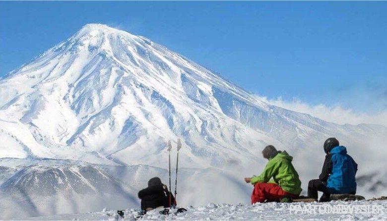
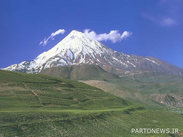
On the way up to Damavand peak from the south face, 3,000 meters high, in a place called “Gosfandsera”, you have to hand over the heavy bags to the four-legged ones so that they can be transported to Bargah Som shelter at 4,200 meters high on the roof of Iran. The beautiful peak of Damavand, with a height of 5,609 meters, is the highest peak in Iran and the highest volcanic peak in Asia. To reach Damavand peak, there are different ways, the most well-known of which are these fronts:
Northern front; The ascent route of this front takes place through two glaciers, Siuleh (right side) and Dobi Sel (left side). The northern route starts from the big rock located in the southwest of Nandel village. This route has two shelters at the altitude of 4000 meters (known as Janpanah 4000) and 4700 meters (known as Janpanah 5000). The beginning of the path is Nandel plain and the path before and after Jan Panah 5000 is accompanied by hand to stone. Apart from the initial sheep shed, this route does not have drinking water and it has a steep slope in the final parts, which leads to the weight of the backpack and the difficulty of climbing.

Northeast front; The northeast route is longer than the other routes. This route starts from Haji Dela village in the north of the peak and after passing Gosfand Sera and Dasht Chaman, it reaches Jan Panah Takht Fereydon, and after the Jan Panah Takht Fereydon, it merges with the traverse of Arouska Glacier at the end of the route and reaches the peak. Returning from the northeast route is usually done from Ghazneh village and Estele Sar area due to the presence of large ski sand.
In this article you will read:
The four-front path to the roof of Iran
Western Front; The western route starts from the parking lot at an altitude of about 3400 meters and after about 3 hours of climbing, it reaches the Simorgh shelter and continues on the western ridge leading to the peak. There is water in the Simorgh shelter and the slope at the end of the western path is relatively high.
south front; From the southeast side of the mountain. Pleur, Rineh, Gosfandsera and the third court are located on this route. The most common and busiest route to Damavand is the southern route. The hiking of this route starts from a place known as a crossroads, where the dirt road towards the mosque separates from the asphalt road connecting Pleur and Reine. After passing the mosque and the sheepfold, it reaches the third bargah, and after that, by climbing the southern direct ridge and passing by the ice waterfall, it leads to Sulfur Hill and finally the peak. Due to the high traffic, the bumps of this route are very clear, and there is no conflict with rocks on this route.
The easiest of these routes is the southern front and the most difficult is the northern front. The three fronts, north, south, and northeast, are located near the villages, and they all have shelters on the way. In the south, there is a waterfall that is frozen all year round and flows only in very hot summers, which is why it is called that waterfall. It is called ice. Located at an altitude of 5100 meters, this waterfall is the highest waterfall in the Middle East in terms of height above sea level.
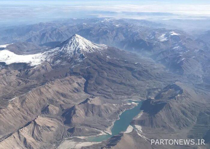
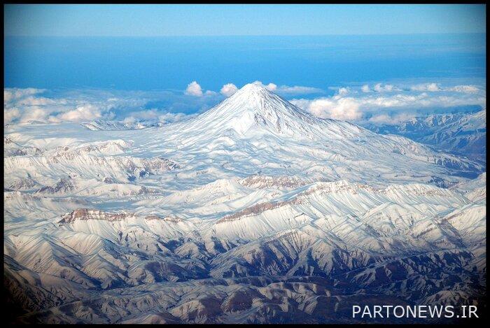
Damavand; The highest volcanic peak in Asia
The oldest route to climb to Damavand is the southern front route. To reach the beginning of this route, you can drive with 4WD vehicles from Rineh roads, up to a height of 3 thousand meters and a place called Gosfandsera. In this place, you can hand over the heavy bags to the four-wheelers to transport them to the shelter of Bargah Som at an altitude of 4,200 meters.
The third court provides drinking water and toilets; After a night’s rest, you have to leave for the peak the next morning. At an altitude of 5,000 meters, you will see an ice waterfall and at an altitude of 5,400 meters, a sulfur hill, and finally, after a lot of effort, you can climb to the beautiful and dreamy peak of Damavand. The timing of climbing this peak depends on the physical fitness of the climbers. In total, it takes about 12 hours of hiking from Gosfandsera to Damavand Peak.
In ancient literature and contemporary poems, Damavand has been mentioned many times:
The ode of Damavandiyeh II is one of the famous poems with a national-patriotic perspective, which was written about Damavand in 1301 by Malek al-Shaarai Bahar, which reads as follows:
Oh, white-legged devil in the cage! / Oh Gate Gate! O Damavand!
From the wire to the head of one head / Zahan to the middle of one belt
So that the human eye does not see you on / hidden in the clouds, beloved face
Until Varahi from the tail of the stars / Vienna, people are like demons
Alamkoh, the second roof of Iran
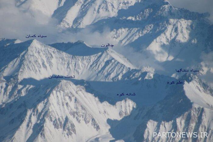
Alam Kouh peak in Takht Suleiman region
Alamkoh peak with a height of 4,850 meters is the second highest peak in Iran and the highest peak of the western Alborz mountain range, which is located in Takht Suleiman region and has one of the most beautiful hiking trails in Iran. The easiest way to climb the south face is to reach this peak, you have to go from Chalus road towards Rudbark and park your car at the Mountaineering Federation headquarters and use a 4WD vehicle to travel the 13 km dirt road.
Start hiking from Tang Golu at an altitude of 3,300 meters and after about 2 hours you will reach the beautiful plain of Hesar Chal at an altitude of 3,800 meters. After a night’s rest, you can climb the Alamkoh peak the next day. Along the way, you will see large glaciers that you have to cross carefully. From the top, you can see the beautiful peaks of Takht Suleiman (Chalon, Siah Sengah, Shaneh Kouh, Siah Kaman), which are a collection of peaks above 4,000 meters.
Clonchin; Overnight with the nomads
Klonchin is located between two big rivers, Kohrang and Bazfat
Klonchin peak with a height of 4,230 meters is the highest peak of Chaharmahal and Bakhtiari province and the highest peak of Zardkoh Bakhtiari mountain range. Klonchin is located between two big rivers, Kohrang and Bazeft. To reach this peak, you can use three routes, the most common and fastest of which is the eastern valley route, which starts by entering Kol Khadang valley.
This valley is usually covered with snow, and the best time to climb it is in the summer season, and to reach it, you have to move towards Chelgerd, 92 km from Shahrekord, then by using 4WD vehicles, on a 13.5 km long road. Get to the beginning of the valley. It is better to rest on a part of the route along the valley or spend the night at the beginning of the valley with the nomads and climb to Klonchin peak in the morning of the second day. The use of an ice breaker is required in this program.
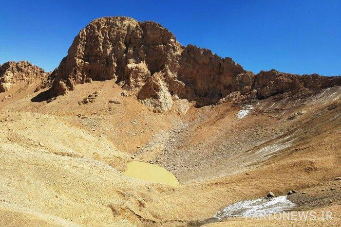
Sablan; Semi-extinguished volcano
The highest lake in the world at Savalan peak
Sablan Peak, or Savalan in Turkish, with a height of 4,811 meters, is the third highest peak in Iran and the highest peak in Ardabil province. Sablan is a volcanic and semi-quiet mountain, the most common way to climb it is the northeast face. To reach the beginning of the hiking trail, you should go from Ardabil to Lahrud and then Shabil hot spring.
After reaching Shabil, you can rent a four-wheel drive (4WD) and drive the 21-kilometer route to the northeastern shelter at an altitude of 3,730 meters, and after about 5 kilometers near the peak at an altitude of 4,726 meters, you will reach the beautiful stone of Mihrab. Finally, after about an hour of hiking, you will be on the summit.
On Sablan peak, you can see one of the highest lakes in the world, the diameter of this lake is 146 meters and its surface is covered with ice all year round, except for summer.
warehouse snow; A valley full of snow and ice
Anbar snow in the southwest of Ferdo village in Qom
Barf Anbar peak with a height of 3 thousand and 233 meters, the highest peak of Qom province, is located in the southwest of Ferdo village of Kohak county, 60 km from Qom city. The name Barf Anbar is derived from a valley next to the peak, where a lot of snow accumulates in winter and is full of frozen snow until summer.
To reach the beginning of the hiking trail at 2,250 meters in Arafa, you have to enter the first dirt road after Fardo village and drive three kilometers by car. Start hiking on a gentle slope and after reaching the Parsa spring and collecting water, use the Pakub path to enter the Samit valley to reach the ridge. In total, you will reach the Snow Anbar peak after about three hours of hiking.
Near the peak, a shelter with a capacity of 50 people has been built, which climbers can use to rest and spend the night in adverse weather conditions.
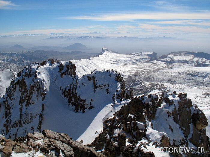
Thousand; It is 4501 meters
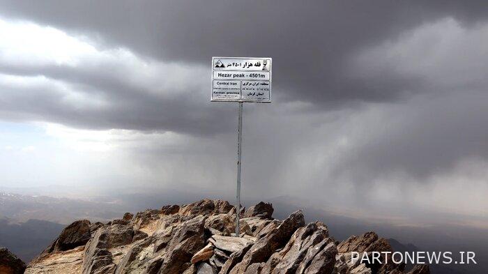
You have to cross the Rhine Falls to climb to 1000
Hezar peak with a height of 4,501 meters is the highest peak in Kerman province, which is located in the southwest of the city of Rain. To reach the peak of Hezar, you can climb from two routes, the northern front route is considered a more common route and should be from the city of Rain. And climb over the Rhine Falls.
Of course, the south-eastern front has an easier, more suitable and higher route. To climb this route, you need to go from Rask village to Ordikan village by 4WD and then start hiking next to Erdikan waterfall at an altitude of 3,461 meters.
By passing the waterfall on the way to Pakub, you will pass a Guwara spring called Boncheshme. By continuing the path in steep slopes, you will reach the ridge that ends at the peak, and finally, after five hours, you will reach the beautiful peak of Hezar.
read more
Introduction of 11 waterfalls of the country
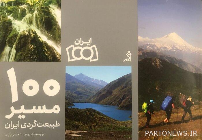
100 nature tourism routes of Iran
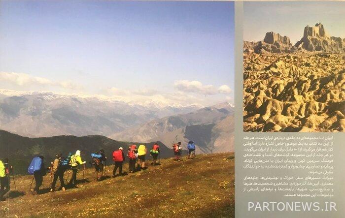
The book 100 Nature Tourism Routes of Iran explains the characteristics, geographical coordinates and routes of 38 known peaks of Iran with short and informative writings, eye-catching and rarely seen images for those interested in travel and tourism in the heart of nature.
One of the necessities of travel and tourism is to study about the travel destination, it is possible to get information and knowledge about the route and destination from various sources, internet search, talking to people who have experienced traveling to those destinations, and reading books. However, if the goal of tourism is in nature, finding and choosing the best and safest routes, how to navigate and get to know the climate of the region, requires a reliable source such as a book, a book written by a professional nature tourism guide.
The book of 100 nature tourism routes of Iran written by Parviz Shojaei Parsa (1401 / Agar Publishing) in addition to introducing peaks, waterfalls, lakes, wetlands and salt domes, provides explanations about pedaling, navigation, canyoning, wandering (off-road) and the main and secondary routes of these attractions. He has presented to those who are interested in hiking in nature, which according to him is “the result of fifteen years of travel, experience, observation, research and photography in the mountains, deserts, deserts, forests, rivers, valleys of different provinces of Iran in the form of reconnaissance and research patrols”.
In the introduction of this book, it is stated that “a tourist in nature requires respect for it, learning and paying attention to technical and scientific points that prevent harming nature is obligatory for every tourist and nature lover.” Undoubtedly, beautiful Iran has numerous routes and destinations that cannot be addressed in this book, but I hope we can take better and more worthy steps in the near future and in other books.
The author of the book, which is a guide for nature tourism, reminded the enthusiasts that it is necessary to carry navigation tools such as a compass, GPS and, if necessary, to use the information of a technical instructor or a local guide in many trips, and you should be prepared for it, as well. Technical knowledge and having the necessary equipment and facilities for any type of trip is an important principle without which no trip in nature is possible.