“NASA Earth Observatory” satellite image of Sistan dust storm
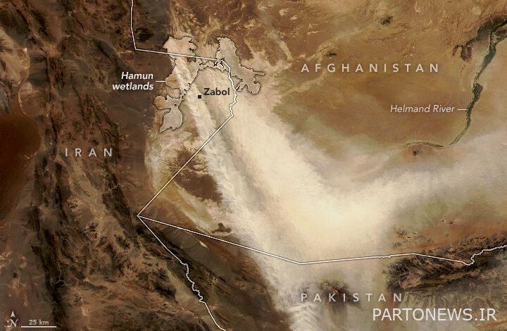


The NASA Earth Observatory satellite image of the Zabul dust storm shows that the dried Hamun is the main source of these storms.
According to the social reporter of Moj news agency, a new satellite image from NASA’s Earth Observatory shows a dust storm that moved in parts of Iran, Afghanistan and Pakistan in mid-September and is still ongoing.
This image, obtained by the VIIRS (Visible Infrared Imaging Radiometer Suite) instrument on the NOAA-NASA Suomi NPP satellite, shows thick plumes of dust blowing hundreds of kilometers across the arid region of Pakistan and Afghanistan, NASA said. It seems that the dust originates from the Hamon wetlands, which partially surrounds the city of Zabul in Iran.
When Hamoun dries up, the region becomes a hotbed for dust storms due to a persistent weather feature called the Loar wind (120-day wind), which blows from the northwest from late May to late September, the report said. It involves Sistan and Baluchistan in the southeast of Iran.
According to NASA, more than two decades have passed since the low water level in Hamon Lagoon, which has led to a significant increase in dust storms. This is especially the case during the 120-day winds, the strong summer winds that occur from late May to late September.